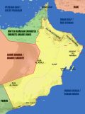
Geography
The Sultanate of Oman has border with Yemen, Saudi Arabia, and the United Arabian Emirates. It has 1700km coast line along the Indian Ocean and the Sea of Oman. The Musandam Peninsula forms the Ormuz straight together with Iran.


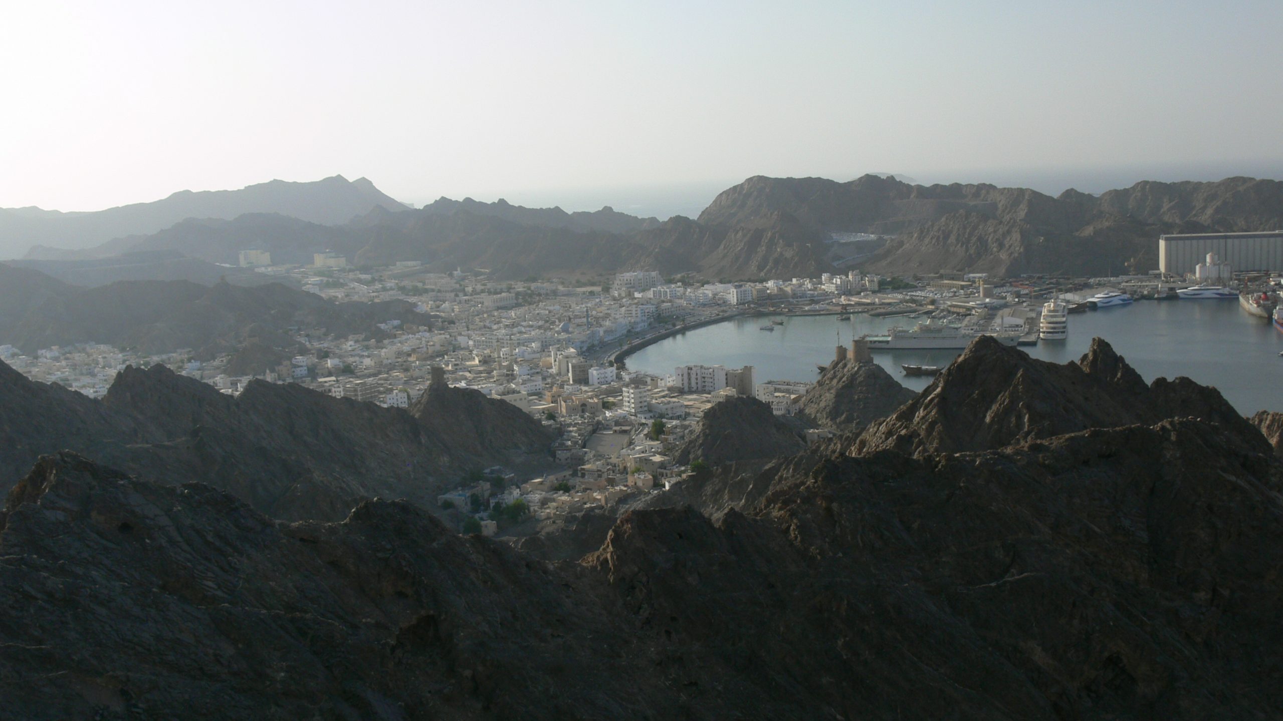
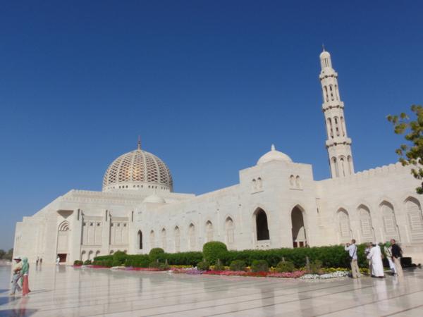
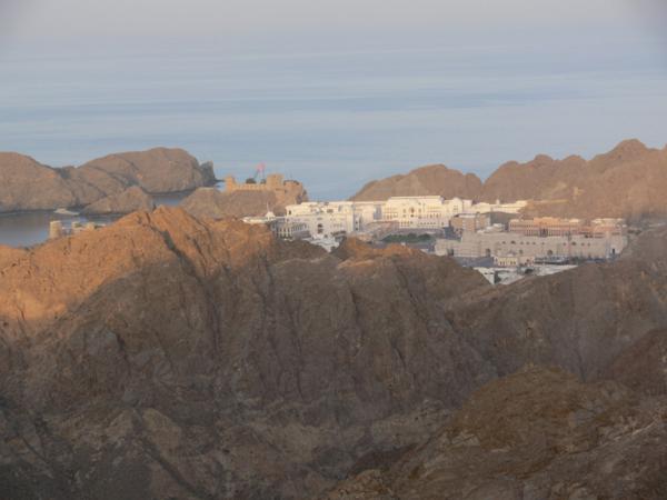
MUSCAT
Muscat’s region is the more populated one. Even though, as for a capital, it remains quite a small city. Surrounded by mountains on the east and south, the city grew up toward the west along a narrow coastal plain. If we consider Muscat itself (the old city) without its suburb, it is the smallest capital of the world with an area of only 3 km2.
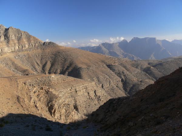
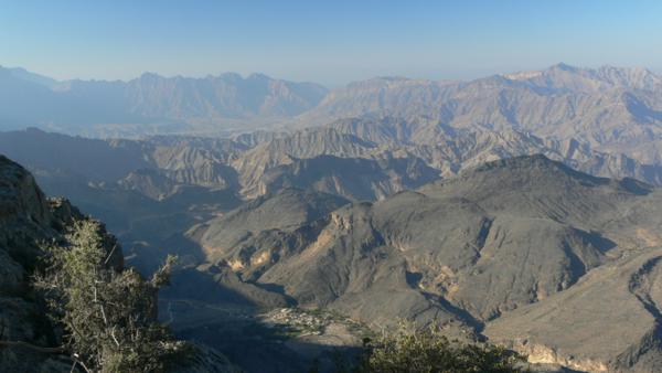
WESTERN HAJAR
Jebel Shams, the higher peak of the country reaching 3009 m, is in this mountain range.
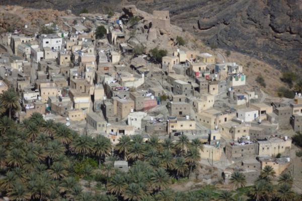
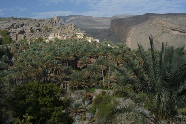
On the northern side, long and uneven valleys flow toward the sea: Wadi Mistal, Wadi Bani Kharus, Wadi Bani Awf, Wadi Sahtan. These valleys host many mountain oases, nested at the bottom of the valleys as well as hanging on the cliffs.
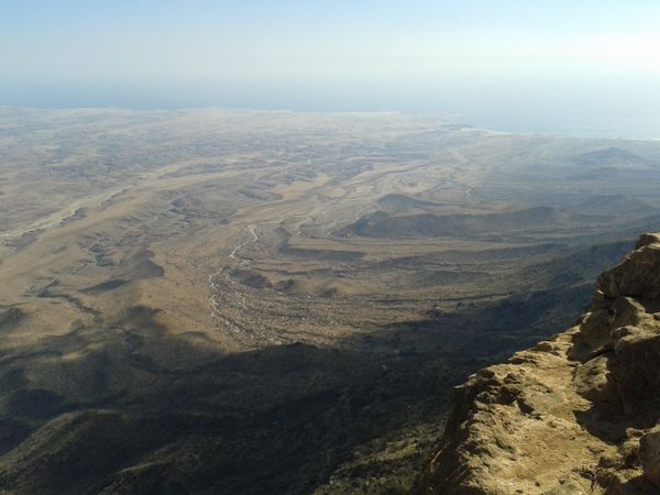
On the southern side, the most oriental part of the range is the Jebel Akhdhar’s “plateau”, quite a wide high area with an altitude varying from 1800 to 2400m. The cooler weather allows the growing of fruits and vegetables of temperate climates. The wild vegetation is of a dry Mediterranean type and more abundant: wild olive trees, juniper trees, etc… Quite long canyons flow down on the southern side (Wadi Al Muaydeen, Wadi Tanuf, Wadi Kamah)
In the central part of the range the southern side consists of sloping limestone slabs cut by narrow though short canyons.
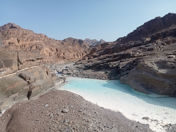
The highest peak is located at the far east of the range: Jebel Shams (3009m) overlooks Wadi Sahtan on the north and Wadi Nakhr on the south. Wadi Nakhr is better known as “Arabia’s Grand Canyon” and its depth at some places reaches 1500m.
THE SAMAIL GAP
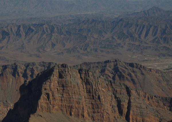
It is a low hilly and rocky area located between the Western and the Eastern Hajar. The rocks here are called ophiolites ; they are the rocks of the oceanic crust.
The Samail Gap has always been the main way to cross the mountain range; now the highway linking Nizwa to Muscat passes there.
EASTERN HAJAR
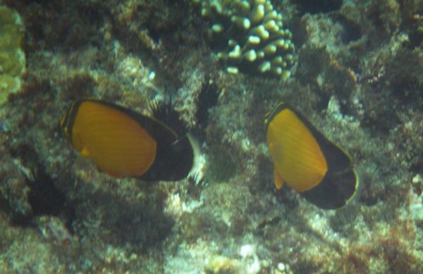
The western part of this range has a very uneven relief. It hosts wadi Dayqah, the wadi with the bigger flow in all Oman, and Wadi Al Arbeyeen. It’s also in this area that we can find the last remaining Arabian Thars, animals which look like wild goats.
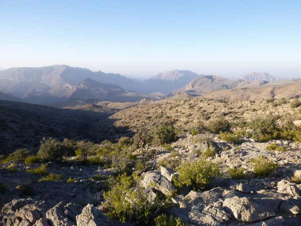
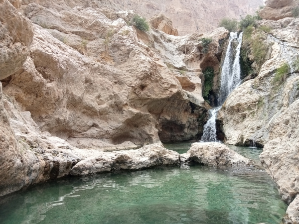
The rest of the range is a wide plateau which highest point is around 2400m. Very arid, the plateau is cut by deep canyons and many of them are blessed with a lot of water flowing all year long making them green and luxuriant. Its scarse population with particular traditions constantely move from the plateau where animals are grazing to the valleys where they cultivate.
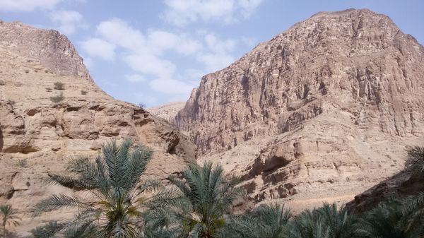
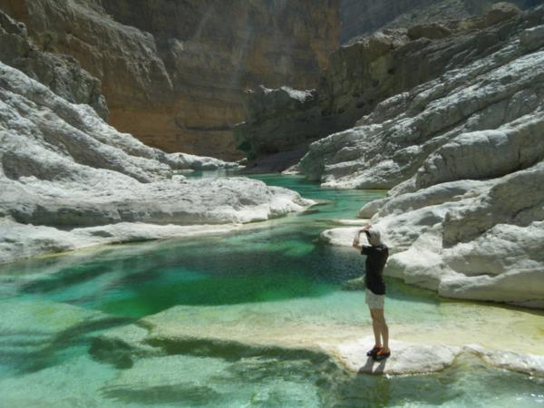
On the northern side, the canyons arrive to the sea: Wadi Al Arbeyeen, Wadi Taab, Wadi Shab, and Wadi Tiwi, among others. On the southern side, the water flows toward the Wahiba Sands like in Wadi Bani Khalid where we can swim or do canyoning just a few steps from the desert.
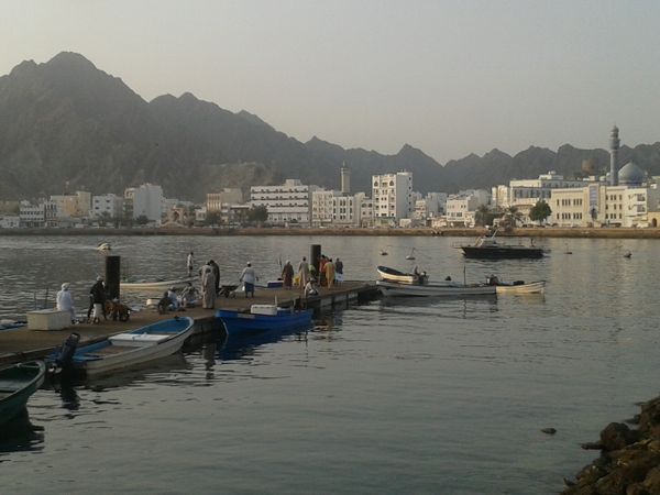
THE SEA OF OMAN
The coast west of Muscat is a coastal plain approximately 40km wide. It stretches up to the city of Sohar near the border with the United Arabian Emirates. The water flowing from the mountain trickle into it and can be drawn lower down for agricultural purposes. It’s a densely populated area.
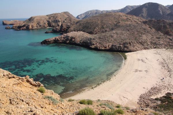
East of Muscat, along about 50 km, mountains dip into the sea and form a wonderful landscape made of numerous wild secluded coves.
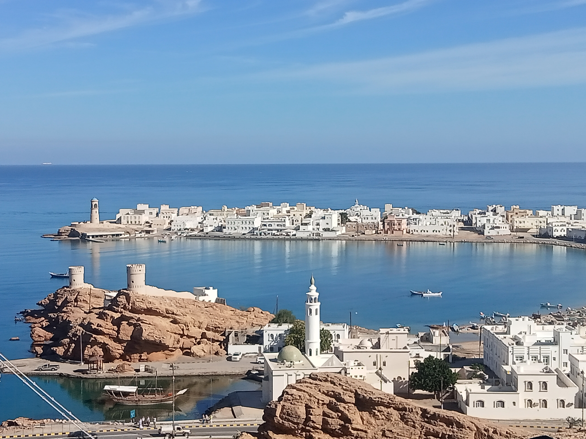
Then the coast stretches at the foot of the Eastern Hajar until Sur.
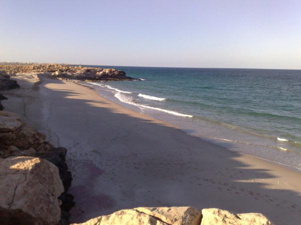
The coastline then consists in smaller shelfs punctuated by sandy or rocky beaches up to Ras Al Had, the cape located at the limit between the Sea of Oman and the Indian Ocean.
THE CENTRAL PART
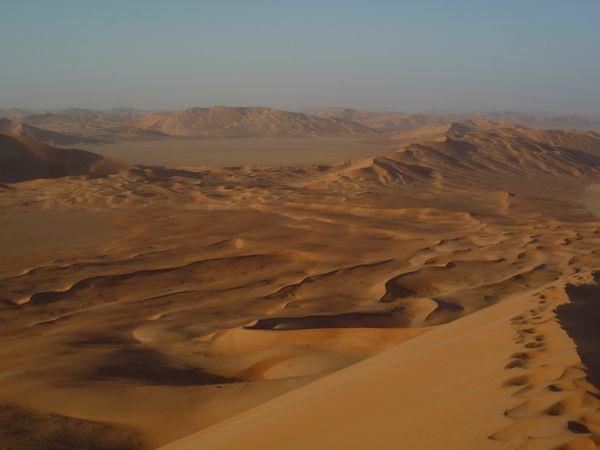
Between the northern mountains and the mountains of Dhofar, a wide desertic area, mostly drear, offers in some places spectacular and unexpected landscapes.
The Wahiba Sands start on foot of the Eastern Hajar and stretches along the Indian Ocean for 300km.
The Rub Al Khali (Empty Quarter) is the well-known wide desert of Arabia, the most arid and inhospitable of the world. Mainly located in Saudi Arabia, it goes beyond the Omani border in several locations.
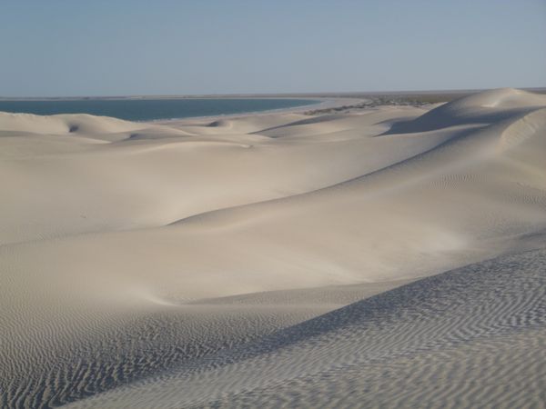
A salt desert, Umm As Samim, lies not far from the border with the United Arabian Emirates.
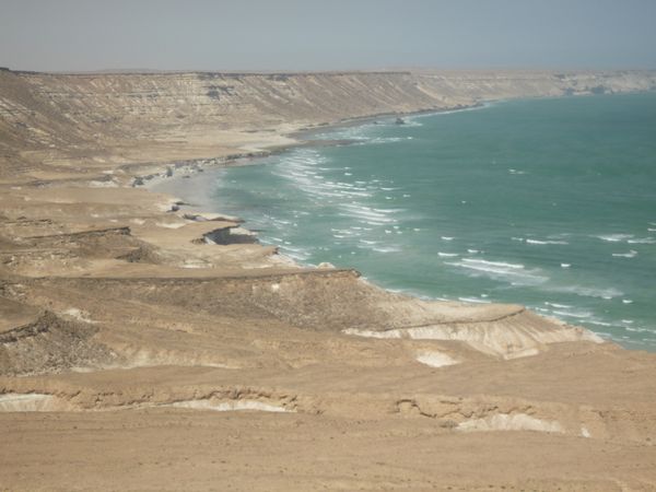
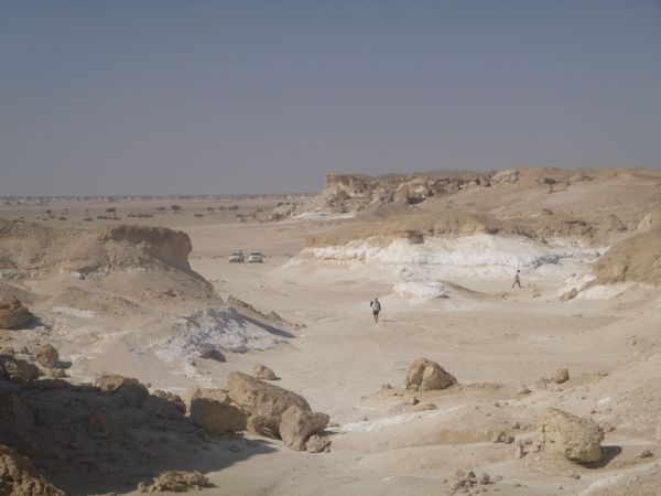
The Huqf region is a serie of rocky escarpments from the inland to the Indian Ocean, and it offers surprising landscapes where sand and rocks meet.
The coast of the Indian Ocean is very wild and offers diverse landscapes: sometimes rocky, sometimes never-ending beaches, and even white sand dunes…
DHOFAR
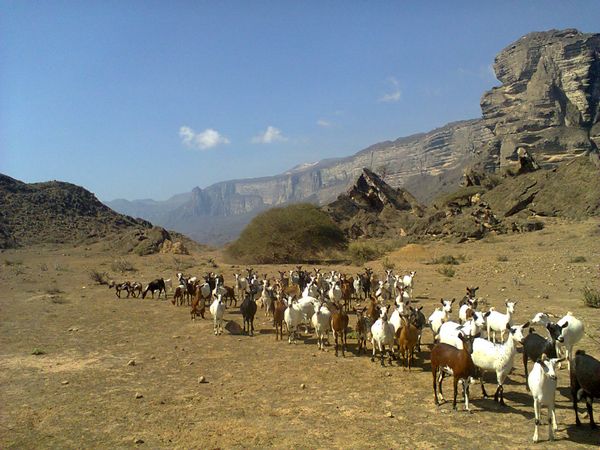
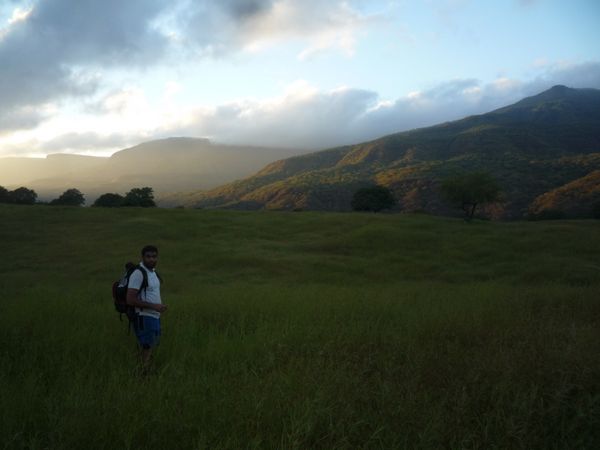
Dhofar is a particular region in Oman: it has a different climate, fauna, and flora. This region is blessed by the monsoon’s tails which are blocked by Dhofar mountains from July to September. The weather becomes at that period tropical humid. The mountains become all green, and we can see cows and camels pasture on together in abundant prairies…
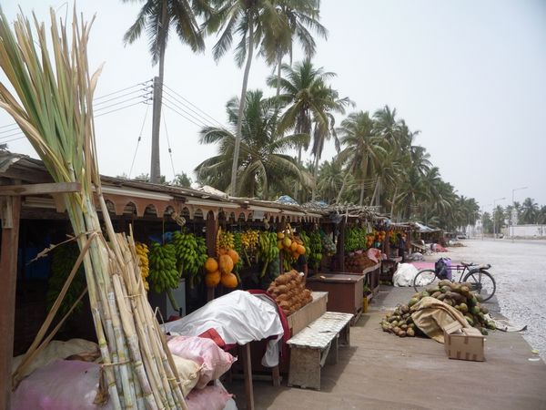
Its capital city, Salalah, is located in a coastal plain between the two mountain ranges and hosts huge coconut plantations.
Known in the Antiquity as “Arabia Felix” (The Lucky Arabia), Dhofar was part, together with the kingdom of Hadramout (in actual Yemen), of the main frankincense production area, which was at that time more valued than gold. This resin brought wealth and prosperity to the region.
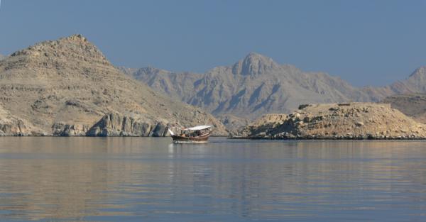
MUSANDAM
This Omani enclave in the United Arabian Emirates forms the Ormuz straight on the Arabic side. It’s a strategic area that makes Oman the guardian of the Gulf. It’s also a wonderful place known as the “Arabic Norway”, because of its uneven coastline where mountains higher than 2000m dip in the sea and create landscapes which remind of the Norwegian fjords.